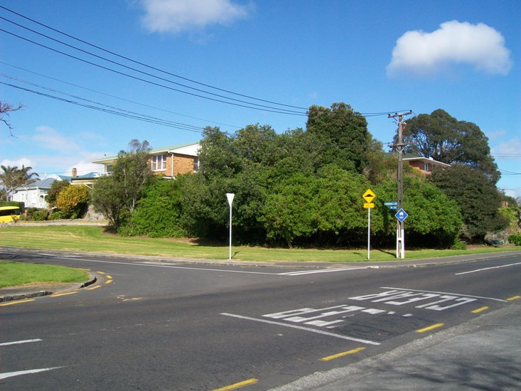
Asquith Avenue, 28 July 2012, looking south from the railway level crossing.
Back in the 1980s, when I first picked up a copy of Dick Scott’s In Old Mt Albert and read it cover to cover, looking for the connections between that district’s history and that of my own Avondale, I believed what the book said. Everyone then held Mr Scott’s work up as a fine example of local history. In many respects, it is still that today, if a little dated, and with the holes in the research much widened under our digitised-database view, along with increasingly tattered edges.
One of those lapses is Scott’s story about Asquith Avenue as being a “chain-gang road”, formed by Irish army deserters in the early 1860s. The story has permeated Mt Albert local history since his first edition in 1961, was perpetuated in bronze by the Mt Albert Community Board in 1995, included in the first newsletter of the Mt Albert Historical Society and essentially repeated as true in the recent Owairaka-Mt Albert Heritage Walks brochure by Carron Boswell, also funded by Eden-Albert Community Board in 2010, and published early 2011. But – I doubt the veracity of the story of the “chain-gang road”. Looking into the story behind the cutting that goes through the scoria lava flow has been for me, over the past few days, much like the chipping away of the rock with pick axes and other tools undertaken by the roading contractors of the day.
For one thing, Scott described it as “once the main route north”. I’ve had trouble reconciling that statement for the last thirty years or so, actually. “Blocked by the swamp at Western Springs the Great North Road swung left to follow the Western Springs Road ridge and then down through the solid rock of Asquith Avenue to continue along the present day New North Road.” Interesting, but … Asquith Avenue predated most of New North Road which wasn’t even properly surveyed past Eden Terrace until the mid 1860s and A K Taylor’s first sale of his “Albert Park” and “Morningside” properties. In fact, New North Road between Mt Albert Road and the Asquith Ave junction was all part of Asquith Avenue up to the mid 1860s, and the development of what was to become Mt Albert’s main road, relegating Asquith to the status of a back or farm access road. The Mt Albert end can be seen on Samuel Elliott’s survey now filed by LINZ as SO 927, dating from before the time A K Taylor purchased his lands (mid to late 1840s).
The Great North Road, or Karangahape Road to go by an early name, didn’t stop at or become diverted by either Asquith Avenue or Western Springs Road. It continued on, passing by Pt Chevalier, the future site of the Asylum, what would become Waterview, and on to Avondale and the west. The Mt Albert back roads were connections, rather, between Great North Road and the interior of the isthmus: Mt Albert Road in particular, and possibly also tracks which became the Kingsland or Cabbage Tree Swamp Road (Sandringham Road). The “main route north” remained the Great North Road.
Western Springs Road, following the ridge by Fowlds Park, although surveyed by Elliott in the 1840s to 1850s (SO 1262), appears to have only become reality when A K Taylor created his first Morningside subdivision, “Albert Park”.
It was between two and three years ago that Mr. A K Taylor resolved to sell a portion of his farm, and with a view to that object, sought and obtained the aid of others interested in the locality to open a new line of road to commence at the foot of McElwaine's Hill, and join the old Great North Road at the Whau. That movement was successful—it, doubtless, helped to enrich the projector and at the same time largely increased the value of all surrounding properties. The healthiness of the locality, the beauty of its scenery, and the excellent nature of the soil, induced a number of persons to purchase for themselves a plot whereon to erect a house, which they would each dignify with that dearest of all dear names to every Briton's heart— “Home!” Within a few months enclosures were made, houses erected, and a village had sprung up.
(NZH 14 November 1866)
This makes much of what Scott wrote about the importance of Asquith Avenue to early settlers in the district nonsense. He considered that “the block of land in the New North Road-Asquith Avenue area” was “probably the first to be sub-divided in the district”. Unfortunately, “Albert Park” was described in the advertisements of the time as being two miles from the city (Southern Cross 11 November 1864) so it was more likely the area east of Morningside. Taylor’s “Morningside” sections adjoined “Albert Park” (Southern Cross, 11 February 1865). Boswell in 2010 wrote that the “Albert Park” subdivision was shortly after that of “Morningside” – which is incorrect.
I can’t find any contemporary references, in either the Southern Cross or the NZ Herald, to military prisoners being used in chain gangs to cut down and form roads in the Mt Albert area in the 1860s or any other time. Much less a group of men who were not only all deserters from the regiments based here during the land wars, but Irish to boot. If they were going to say they came from an Irish regiment -- why not say, it was the 18th Royal Irish Regiment (which existed, and was in New Zealand during the 1860s). Details, with regard to the story however seem to be almost deliberately vague. Like a yarn passed from neighbour to neighbour over the stone wall fence.
Scott got his information from a piece put together by someone calling himself simply “Tramper” which appeared in the Auckland Star in 1929 (not the NZ Herald, as Scott thought). "Tramper" had a brief career in the paper, sending in occasional snippets of interest from around Auckland and other parts of the country to the Star from 1928-c.1932.
Asquith Avenue was made by the soldiers so that dates it in the early 'sixties. It was known familiarly as the "chain-gang road," because it was made by the defaulters of an Irish regiment. And a spell on that stretch of the road to the far north must have been a most effective method of taming the wildest of wild Irishmen. The defaulters must have cursed the north and the coincidence that threw them and that rocky road, together, for much of it is through solid basalt.
"How on earth those men shifted some of the boulders we have come across beats me," said one of the staff at present engaged in modernising this historic old thoroughfare. "Some of the stones we came across," said he, "weighed seventeen hundredweight.
"Even with our modern gear we found them tough enough, and I can't think how those soldiers handled them, for handled they were: we found that out by the fact that they were packed."
A quarter of a mile or so further on one comes to the Khyber Pass cutting. This part of the isthmus is full of lava flows, and crossing the line of road was a fold of it, much like the fold of a heavy rug or blanket. The Legree of “the chain gang" surveyed right through the fold, and that meant a narrow cutting with straight sides through solid rock, which necessitated much blasting powder and must have caused much bad language. The cutting is about 25 ft high, wide enough for one cart only, and is all the more striking as in the old days the pioneers invariably followed the ridges, and eschewed anything like cuttings or fillings wherever possible.
After the road past the Western Springs and the Stone Jug was built, Asquith Avenue (or whatever it was called half a century back) evidently fell into disuse.
(Auckland Star 29 October 1929)
Looking north, toward the "Khyber Pass cutting".
Where did “Tramper” get his information from? I have a sinking feeling that I know who it might have been – a certain clerk of works at the time, employed by Mt Albert Borough Council from 1928 to 1931, by the name of
Forbes Eadie, at the same time commencing his other career as a teller of sea tales, Lee Fore Brace. His
Scrapbook (still in reference at the Auckland Central Library Research Centre) has been found by local historians today to be of dubious value. Some stories from his Lee Fore Brace series have been called into question, and as for his own personal history – that was written and re-written over the course of his life.
If Eadie was there that day, chatting with “Tramper” – he probably sounded knowledgeable and believable. Forbes Eadie always did. But he had only reached Mt Albert at the beginning of the 1920s, and I doubt he or anyone else at the time had the documentation to prove the story of the “chain-gang road”.
There is, however, documentation against that version of the road’s story.
Detail from SO 1262, LINZ records, showing Elliott's early survey of the lines of Asquith and Western Springs Roads. Written beside the area of the deviation around the height of the scoria outcrop: "A great improvement may be made in the Road if Mr Taylor would allow it according to the dotted lines." In the late 1850s, A K Taylor owned land on both sides of the future cutting, but sold Allotment 172 (to the left) in 1861. This eventually came to be W H Martin's land from 1881, the year before the Old Whau Road contract began.
For starters, the line of Asquith Avenue appears on maps from the 1840s right through to the early 1880s – but with a kink, a line going around the troublesome scoria outcrop, and across it where the land sloped more gently toward the south-east. Today, the nearest road to this original line of the “Old Whau Road” is Amandale Avenue. If the “Tramper’s” Irish soldiers had really forged through the “Khyber Pass” as he termed the cutting which straightened the road – they took their time doing it.
Detail from NZ Map 190, Champtaloup's Map of Auckland, c.1880-1885. Sir George Grey Speciual Collections, Auckland Libraries
By the time we reach the 1890 County of Eden map – the road has straightened, with a wide road reserve in the spot where the curve once was.
Detail from Roll 46, LINZ records
In the intervening time, we have more documentation, in the form of the minute books for the Mt Albert Road Board (MAC 100/2 and 100/3, Auckland Council Archives), the reports of public ratepayer meetings, and advertisements placed in the newspapers.
A petition was presented to the Road Board on 14 April 1882 by a number of settlers “calling the attention of the Board to form the road from Railway crossing and over the hill to Mr Martin’s Gate.” The Board agreed to “form that part of the road leading over the hill toward Mr Martin’s Gate, if the funds at their disposal will permit.”
Looking towards St Lukes Road overbridge, Asquith Avenue level crossing.
The railway line to Helensville had been constructed through the district in 1879-1880, and the crossing, as it is today, was just to the south of the Meola Stream on Asquith Avenue, and the land boundary between the Parish of Titirangi and the Suburbs of Auckland.
Looking towards the dip where the Meola Stream crosses the line of the road, before rising towards the cutting, and St Lukes Road beyond.
William Hurst Martin owned the farm to the west of today’s cutting from 1881 (Deeds Index 6A.366), the Plant Barn nursery on part of his land. Before 1882, the road, after being crossed by the railway, dipped down toward the stream, then took a sharp right turn to avoid the hill, and curved as best as possible (following Elliott’s survey) around the obstruction, toward Western Springs Road.
Looking towards the cutting.
On 5 May 1882, the Board discussed whether it was necessary or not to employ a surveyor. They visited the site on 9 May, and decided to employ Mr Hill in that role (a man with an apt name for the task). Tenders for the task of forming the Old Whau Road were then advertised in June, with Martin offering a sweetener (considering he had a lot to benefit from the work) of providing and spreading scoria ash on the road on satisfactory completion.
Auckland Star 10 June 1882
Henry Hickson Grant’s tender of £89 10/- was accepted on 16 June, but by January 1883, after two extensions of time, things weren’t going all that well for the contract. The Board advertised for tenders to complete the project that month, and accepted J Brown’s tender of £87.
Auckland Star 12 January 1883
In all, the Old Whau Road contract was to cost £148 from the Board (and ratepayers’) funds.
East side of the cutting, 1929 surface.
Brown didn’t have all that much of a better time of it than Grant did. By June 1883, the project was again delayed. Unfortunately for the Board, now the ratepayers noticed.
The Chairman then read a list, showing the amounts expended on the different roads of the district, and explained that the £85 contract was part payment for cutting a hill on the old Whau-road, near Mr. W. H. Martin's property, on which contract there was a farther liability of £63, making a total expenditure for the cutting and embankment of £148 …
Mr J T Garlick seconded the adoption of the report, and enquired why the sum of £148 had been expended on the Old Whau-road for the benefit of a nine ratepayers, who had, so far as he could learn, contributed nothing beyond their rates, while on one short road near the residence of Mr J M Alexander those benefitted had given equal to £17 to meet a similar amount for ash expended by the Board. At the last annual meeting he had informed the ratepayers that the contract then let for £90 would be thrown up. This had been contradicted by some of the trustees, who stated that the contractor for the cutting was prepared to complete the work but if not, the ratepayers (who) benefited were prepared to assist by special contribution. Mr Garlick concluded by asking the Chairman if any subscriptions had been received, and if so the amount? In reply, an extract from the minute book was read by the Secretary, "That Mr W H Martin had guaranteed on behalf of himself and others to ash the road at their own expense as soon as the contract was finished.”
Mr. Randerson inquired if the Board had a written guarantee to that effect? This brought Mr Martin to his feet, when he informed the meeting that "his word was his bond," and the work should be completed in a satisfactory manner. Mr W L Mitchell complained that such a large amount had been expended on the back road to benefit only a few people, while the Kingsland-road was neglected and had in some places nearly three feet of water on it, and that out of a total revenue of over £500 less than £9 had been spent on the New North-road, the main road of the district. The railway crossing at Morningside was the most dangerous one near Auckland. The Roads and Bridges Construction Act had been in force some time, but no action had been taken by the trustees to take advantage at the Act for the improvement of the district. Mr Mitchell strongly urged the ratepayers to elect new men as trustees. Mr. Garlick supported the suggestion of a loan under the Roads and Bridges Act. The motion for the adoption of the report was then put to this meeting and carried. Messrs. Randerson, Young, Martin, Waterhouse, and Taylor addressed the meeting at considerable length on various matters connected with the state of the roads and the duties of trustees.
(NZH 4 June 1883)
The Old Whau Road contract was surely a headache for the Board. Brown was accused at the time of removing stone for his own use, without the permission of the Board; in July the Board was told that the contract “was in a very unfinished and unsatisfactory state.” The surveyor Hill also chimed in with his disapproval as to the fact that, he felt, the contractor had not kept to the plan and specification. Still, the Board was probably stuck with what they had – money had already been expended, their ratepayers were increasingly agitated over the state of the local roads, so they allowed Brown to plow on. The Board’s engineer certified that the work was finally completed to his satisfaction at the Board’s meeting on 1 November 1883, nearly 18 months after the process began. There were probably sighs of relief at the Board’s meeting table in the local public hall.
West side of the cutting, 1929 surface. Just beyond is the Plant Barn nursery site.
Martin, though, wasn’t happy with the state of the road at all, and demanded to see the plans and specifications for his own engineer to examine before he kept to his end of the deal. The Board declined to forward these to him – whether Martin gave up and provided the scoria ash anyway is not recorded.
There’s no mention of all this in Scott’s book, which I find surprising. He refers to other subjects raised in the minutes at the time – weeds, dog taxes, applications to government for roading and bridge construction loans – but not this. Perhaps, believing the Irish soldiers story, he thought this was just remedial work on the road, not the true formation over the hill? Hard to say.
Still, by 1883 the road had been formed and the hill cut. There was now a more-or-less straight access from Martin’s Gate along the rest of the length toward Mt Albert shops. Renamed Avondale Road (probably for no other reason than “Whau” became “Avondale” in 1882), it was again renamed as Asquith after the British politician. Its form was left alone until 1929 when the Mt Albert Borough Council decided to widen it.
According to “Tramper”:
It has now emerged from its loneliness, and the ghosts of the chain gang have been exorcised by the operations of a team from the Mount Albert Borough Council's staff, which is tearing up the old track and putting it down as a modern full-width road, with a foundation of almost Roman solidity—there is no lack of rock in those parts—and with a bitumen surface, not to mention a strip of lawn between carriageway and footpath. It is altogether a fine piece of work, and does credit to the resident engineer (Mr. W. E. Begbie), who, by the by, is the youngest resident engineer in the Dominion.
That straightened part of the road, oddly enough, wasn’t officially gazetted as such until 1940.
Detail from SO 30981 (1940), LINZ records
The old Crown Grant road which curved carefully around the troublesome scoria, through which Grant and Brown and their men chopped and carved in 1882-1883, is now a mix of road and residences.
Amandale Avenue, off Asquith
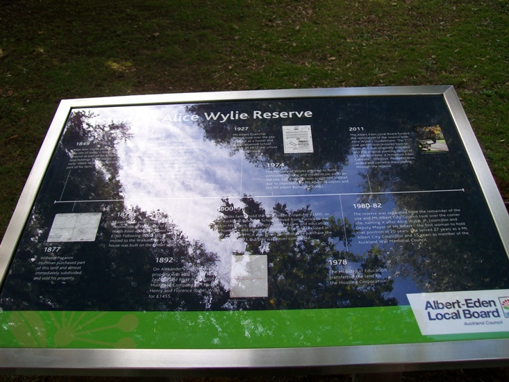
The brass plaque beside a Council-provided seat facing the Plant Barn nursery was stolen after installation in 1995, and a replacement (not brass) installed in late 2011, complete with historical and other errors.
I can’t see anyone rushing to correct it, though. After all, a fondly-held myth about hard done-by Irish soldiers far from home made to do hard labour in the Mt Albert countryside to form a road which I heard someone say a few years ago was “as straight as a gun barrel” is hardly going to be replaced by the story of an 18-month early municipal project, laced with political in-fighting and angry scenes at public meetings, now is it?