Saturday, August 18, 2012

From Constitution Hill to Fraser Park


This postcard was described in TradeMe as showing "Constitution Hill" -- which it does, in the centre background, but the main focus I would have thought would have been the road along which the tram was slowly trundling, called at this point Alpha Road, leading towards Parnell.

Before I get into stuff about what was what ... The back of the postcard intrigued me on reading it today when I opened the envelope from the card's seller. Crammed onto the back, written in small cursive writing in ink pen, is the following:
"Dear Win.
I am writing you a P.C. as I have not got very much news. How is Mc Kinlay, be out with him yet. Who do you think followed Else & I into town. Mr Alf Elliot. Else & I were talking to Nellie Joynt in Newton when he passed. Else didn't notice him so the child passed us again, we spoke to him and never thought any more about him. When we got to town we happened to look back & we spotted him just at the back of us. So we dodged into the Station & we didn't see any more of him. Edie Cross' two cousins from Waikumete are working at Mackay Logans. We were talking to Glady & Bob in town. I think Glady has got the same expression in her eyes as Ern has. I couldn't help noticing it last night. Else's boy & I hate one another like poison, put me in mind of her and his bossy ways, we are just civil to onother [sic] & that's all. Maggie leaving Mennies & is starting at a place in Dominion Road. A much better place. 
Best love from Liz."
Liz, were she a young lady in today's day and age, might well have fitted perfectly into our Facebook and Twitter-dominated social landscape.

Liz's reference to Dominion Road puts this image at some time after 1907, but it's likely from before the 1920s.

I referred to Constitution Hill in an earlier post. It's a part of Auckland I'd be nervy of going down, and would need oxygen to climb up these days. I always associate it personally with bus strikes -- when the bus drivers walked off the job, the only way into town in the 1980s was by train, and that meant a climb from Beach Road up Constitution Hill to Symonds Street for me. Felt as if I'd ripped a lung out.

Others, when the name was first applied to this pathway upwards in the early 1860s probably felt the same. It isn't named after a parliamentary constitution -- I think it was named after Constitution Hill in London, itself said to be named after King Charles II's habit of walking along the (flat) road from his palace to Hyde Park for his health. Then again, Parliament Buildings were close to the top of it, until Auckland was no longer the capital.

Here, though, Constitution Hill lived up to the "hill" part of its moniker.

To the Editor of the Daily Southern Cross, —Allow me to call the attention of the authorities to the present dangerous state of the pathway from the Provincial Council Chambers to Mechanic's Bay. A few loads of gravel, a little fencing, and repair of the gutter are required at once, as otherwise our “Constitution hill” will be impassable during the coming winter. A SUBSCRIBER, May 11th 1863.
SC 12 May 1863
Sir,— That the streets, and even the footways, of Auckland, are in a deplorable condition, I think no one would attempt to deny; and in many parts the passage of them involves positive danger to life and limb; none, I think, more so than the particular portion to which I would desire, through your medium, to call the attention of the proper authorities. I allude to the hill facetiously called Constitution Hill, namely, that which loads downwards to Mechanics’ Bay, from the front of the House of Assembly. I do not think that I can be accused of exaggeration in saying that this does actually endanger limb, if not life, and several, to my knowledge, have already had spills, and been much bruised. Any person who may have required to travel it last night, or even this morning would, I think, bear me out … 

SC 2 June 1865


Up to the period I write of, no attempt has been made to overcome the handicap of the cruel hills that shut Parnell off from the city. The railway line along the foreshore was only in the rough, and in any case when the crawling, poisoned trains entered the tunnel. Parnell, the harbour end, was left "in the air," so to speak. I wonder how many dwellers of the eastern suburb—"Parnell, pride and poverty"—of to-day can even visualise what Constitution Hill meant to the dwellers of the 'seventies and 'eighties. It was a veritable mountain, and in earlier days had evidently been an abrupt, towering cliff with the waters of Mechanics' Bay laving its feet. A ridiculous goat track led down from where, eventually, the Supreme Court buildings perched on its crown, and that track was ungravelled and barely drained. It was a dangerous track even for young folk and in daylight. Imagine, then, what terrors it presented to the wives of business men detained in town after dark —which, of course, nearly all were in winter. I remember hearing the wife of my uncle, John Reading, giving to my mother and aunt a graphic account of her own experiences in that respect. She told how of a rainy night, she would put the little daughter, Julia, to bed, wrap her head in an old shawl, and start out to meet her man. Remember, there were practically no street lamps in those days, and the main road was nothing but a few loads of blue metal thrown down in a quagmire. It was bad enough before Constitution Hill was reached, but then the poor creature's troubles really began. The slippery cliff path was a nightmare to her when her husband had to traverse it in the dark. In the seventies a scared goat could not safely have negotiated the hill at a gallop. 

Auckland Star 28 July 1928

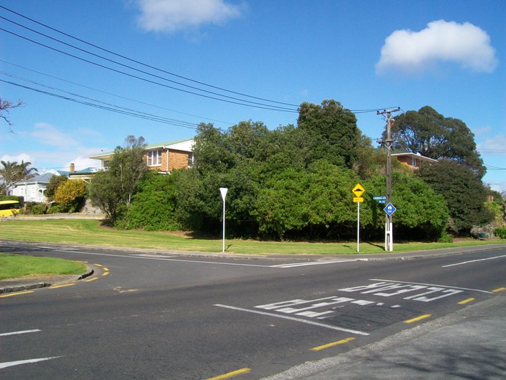
Then we come to the road the tram is travelling upon. As I said, at this point in time the image was taken, it was Alpha Road, and had been since at least 1882 (the earliest reports seen in Papers Past, when the Parnell Borough Council were budgetting for a footpath to be formed there). Like Constitution Hill, it's a fair bit of a climb up from Mechanics' Bay. Before 1882, it was part of The Strand. From late 1938, it was Gittos Street, after Rev. William Gittos. Then, in the mid 1980s, it was renamed again to Parnell Rise.

What the tram is passing to the right of the picture is the site of Parnell School.

"Looking north east from Constitution Hill up Parnell Rise, with Parnell Road (top) and Augustus Terrace (left after railway bridge) with the Parnell School, Parnell Railway Bridge, Swan Hotel on corner of Stanley Street (right), Maori Hostelry (foreground) and City Steam Laundry on opposite side of Gittos Street (now Parnell Rise)." 28 September 1900. Reference AWNS-19000928-6-1, Sir George Grey Special Collections, Auckland Library

Just right of centre, above the railway overbridge in the image above, you can see the old Parnell School.


Detail from DP 7386, LINZ records (1911)

In 1875, the triangle of land between the three roads was granted by the Crown to the Auckland Provincial Superintendent for use as endowment property to provide income for the asylum at Pt Chevalier (NA 6/180). Then, in 1878, moves were made in Parliament to take a chunk of the asylum endowment property as a school reserve.
PARNELL RESERVE BILL.
Mr. Moss moved very briefly the second reading of the Parnell Reserve Bill. This bill was given notice originally as the Parnell School Reserve Bill, but the word "school" was dropped out subsequently, inasmuch as such a reserve would necessarily fall into the general education endowments, and seeing that the reserve was meant for the Parnell Borough Council, this result would have proved untoward. Mr. O'Rorke objected to the measure, on the grounds of Mr. Moss's extreme moderation; a much larger area of land ought to have been granted to the Borough. Mr. Dignan said that the land asked for was from portions of land long ago set apart as endowments for the Auckland Lunatic Asylum, and he strongly deprecated the attempt to deprive such an institution of its just right. Had Mr. Moss asked the Government for a small portion of the Auckland Domain grounds as endowments, and that ground was only about a hundred yards distant from the boundary of this Borough, he should have readily supported the claim, but he felt bound, on the score of justice, to object to this proposal to take from the Lunatic Asylum a portion of its too small reserve. If the House could consent to such a thing, what charity was safe—what institution of the kind in the colony was safe. He moved, “That the bill be read a second time this day six months.” After some consideration, the Speaker ruled that the schedule of the bill was informal, and so the matter is delayed. Mr. Moss will move in the business again, and probably may ask for a small slice of the Domain. 

NZ Herald 15 August 1878


The school, probably c.1880 just after it was built on the reserve for £2000. Reference 1-W257, Sir George Grey Special Collections, Auckland Library.

The Parnell Reserve Act 1878 was passed, though, and the land went to the education board.
Opening of the Parnell District School.
This building, which is intended for the public school of the Parnell district, is now almost completed, and is really a magnificent specimen of architecture. The whole work of building has been carried out under the management of Mr Connelly, and the present edifice reflects great credit both upon him and the workmen … According to announcement, the public opening took place this afternoon, when there were about 350 children present with their teachers and parents, and they behaved themselves in a very orderly manner. Mr Leonard, the head-master, has great command over the scholars. Mr Winks occupied the chair, and in the opening proceedings remarked that … he was very much pleased to see so many present in the interest of education. Their thanks were due both to the local Board and Mr Moss for obtaining the present magnificent building and site … 

Auckland Star 3 May 1880

A small bit at the corner of Mechanics Road (now Augustus Terrace) and (what was then) Parnell Rise (now part of Parnell Road) was transferred to the Parnell Borough Council in 1914. (Pt. 107 in the plan above) This ended up as the site of the Borough Council offices -- made redundant when Parnell amalgamated with Auckland City a few years later.

By 1932, it was realised that the site at the top of the hill was inadequate for a school in a busy suburb. The following year, the school shifted to St Stephen's Avenue. 

What will be the future of the. historic site of the old Parnell School? The Mayor of Auckland, Mr. G. W. Hutchison, who is an old boy of the school, has taken up the matter with the Minister of Education, the Hon. R. Masters, and urged that the site should be set aside as a public reserve to improve the amenities of the locality, but the Departmental view—at the moment—is that the land should be sold to the highest bidder as an offset to the cost of the new Parnell School building, which was recently opened. There is still, however, hope of the development of the area on aesthetic lines. To-day the well-known triangle is a scene of desolation, with the exception that exotic trees planted many years ago suggest how well a park scheme or reserve could be developed. The apex of the triangle was formerly the site of the Parnell Borough Council offices, the buildings being removed when the eastern side of Auckland was embraced in the city area. There are thousands of Aucklanders who attended the old Parnell School during its long history, and they will share in the view that the site should be set aside for all time as a public reserve …

Auckland Star 18 November 1933

The land was zoned for business and industrial purposes in the town plan. On 8 June 1934, the department tried selling the subdivided site at auction -- but the auctioneer failed to get even a bid of £1000. (Star 8 June) These days, a piece of prime land like this in Parnell would have had bidders lining up with their wallets to purchase even a smidgen, I'd have thought.

Suggestions were made in the press from the public that the city council should consider leasing the site as a recreation reserve, to prevent "[the district's] entrance [from being] disfigured by unsightly buildings." (Star, 17 May 1935) It was suggested that the area could become another of the city's playground areas being set up during this period (see also my post on Basque Park). The Minister of Education, Peter Fraser, even went so far as to offer the site to the Council for that purpose. But the city engineer, Tyler, wisely noted the fact that the triangle is an island in the middle of heavily used routes for traffic, especially the increasing numbers of motor vehicles. The topography was another problem, making any development above that of a few tennis courts an expensive proposition. Councillor Ellen Melville, interestingly, suggested that the area revert to a use similar to that which the education department had envisioned: turn the site into a collection of workman's homes. (Star 14 October 1936)
 Auckland Star 1 May 1937

Still, the council, with the assistance of the unemployment schemes, started a project to terrace the triangular reserve early in 1938, with the view to creating a public amenity. (Star 22 January 1938) A municipal park needed to have a name -- and Parnell Park was already taken (though today, that park now has another name.)

"There is no political significance in this," commented the Mayor, Sir Ernest Davis in suggesting to the Auckland City Council last night that it could do no better than name the old Parnell School site which is being transformed into a recreation ground, "Fraser Park". The Mayor made the suggestion because of the active interest taken in the proposal by the Minister of Education the Hon P Fraser.

Auckland Star 29 April 1938

Still, considering Peter Fraser went on to become our Prime Minister during World War II, that does add a certain something to the name.

The former asylum endowment land / school property was transferred back to the general government as Crown Land in 1939, and then gazetted as a recreation reserve in 1940, vested in the City of Auckland. (NA 186/67) Still with the education board's 1914 subdivisions existing on paper, the site remains as a Auckland Council public reserve.

2010 aerial view, Auckland Council GIS

Thursday, August 9, 2012

The latest article on Boyd's Zoo

Journalist Andre Hueber from  the Aucklander called me recently about finding information for one of his articles. He interviewed me last year for the "Property Detective" story, so in chatting asked what I was giving talks on during this year's Auckland Heritage Festival. Blockhouse Bay Library will be hosting my talk on J J Boyd and the Zoo War, so -- Andre asked for more info, and I end up being mentioned in dispatches again.


I'm glad more is now out there on J J Boyd's first zoo in Auckland. He also had the Aramoho Zoo from 1909-1916, so nationally, he takes the honours for the second and third zoos in the country, after Wellington Zoo in 1906.

I'll shuffle off back to the shadows, now.

Monday, August 6, 2012

Weetbix ... Weet-bix ...Weetabix ... more info appears


Evening Post 11 May 1927
  
Well, what I term the Weetbix Saga has been a long one here on Timespanner. It kicked off with my original post: Who invented Weetbix, (19 Feb 2009) in which I had a brain-fart, put an impossible date in the margin of an ad printed off from the library, and reproduced that in error here (producing an "oh look, Timespanner has an error" comment from one of the two sides of the real debate. Well -- the error's fixed, fairly well, now. Never said this blog is error-free ... sigh.)

Lots of comments to that post.

Then The development of Weetbix -- the sequel (24 September 2009), bringing in the Mills of Burton Latimer website (which, it now appears, also got fine details wrong such as the name of the British and African Cereal Company. )

The Weetbix controversy rolled on (14 March 2010) with the publication of John Baskerville Bagnall's article Weet-Bix the Early History supporting the case that his uncle Arthur Shannon came up with the breakfast food.

But now, we have in reply, Yvonne Sainsbury's Weet-Bix Origin and History supporting her father Bennison Osborne as the inventor. In short, she states that her father developed Weet-Bix, had financial backing from Arthur Shannon, who in turn was bought out (as Grain Products Ltd) by Sanitarium, all in the 1920s in Australia. Osborne then travelled to New Zealand with Malcolm Macfarlane, producing the product here with funding from Arthur Shannon. Sanitarium bought him out again, here (in 1930).

 Evening Post 31 March 1927

Bennison Osborne and Malcolm Macfarlane then take their business ideas to South Africa, seek funding that doesn't come from Arthur Shannon this time, and they call their product Weetabix. Sainsbury disputes Bagnall's article, showing that the British and African Cereal Company was private, that there were no public shares for Arthur Shannon to buy up on learning of the other two men's "treachery" and then demand at a shareholders meeting that the product's name couldn't be Weet-Bix. Sainsbury contends that Shannon was refused any financial part in the new company.

Then comes the story at Burton Latimer.

Yvonne Sainsbury quotes from a number of primary sources, and certainly adds to this whole story. Thank you, Yvonne and bonzer, for sharing your info with us here at Timespanner for the past over three years.

Footnote: Looking up some of the early Weetbix ads on Papers Past, I found this:

Which came from the Evening Post, 11 July 1928. Yes, that is the date from the website.

Wikipedia says Cenovis originated in Switzerland in 1931, as does this Cenovis:Tradition page. This page compares the three - Vegemite, Marmite and Cenovis.

Advertisements for Cenovis peter out here in New Zealand around 1933. This might be more of the untold or confused history of Sanitarium-related products -- but I'll leave it for readers to sort it out, for the future.


Tuesday, July 31, 2012

Looking down Queen Street


Another postcard picked up via TradeMe. A car enthusiast has already picked out that, going by the makes shown, the image dates from c.1951 to 1956 (the year when trams ceased operations in Auckland).

It was taken from the Town Hall, and shows (centre, bottom) the still-open Greys Avenue (from which the flat-bed truck is turning), (left, bottom) part of the retail block (by then the Greys Ave "Chinatown") demolished later for Aotea Square. Just north of that, west side of Queen Street, we can see Myers Street (formerly the Market Entrance to the City Markets), now all just part of the Planet Hollywood/Midcity development beside Aotea Square. The five-storey building with Atwaters signage is the Ferguson Building, today just a facade on the streetscape. The site was once that of the Anchor Hotel. Immediate;y behind that is the tall almost-oriental tower of the Civic Theatre. To the left of that on the skyline, the rear part of the Smith & Caughey building.

To the right, shops at the corner of Rutland Street, heading down to the St James Theatre (colourised red turret), a Dewars Whiskey neon advertisement from the rear, and to the left of that on the skyline "JCL" (for John Court Limited, where Whitcoulls is today, corner Victoria and Queen Street).

To compare, here is a view from 28 November 1963 (by kind permission of the Sir George Grey Special Collections, Auckland Library. Photographer unknown). Reference 7-A1042.


For this one, though, the photographer got just that bit further up the height of the Town Hall.

Sunday, July 29, 2012

Street Stories 24: Asquith Ave -- not a “chain-gang road”

Asquith Avenue, 28 July 2012, looking south from the railway level crossing.

Back in the 1980s, when I first picked up a copy of Dick Scott’s In Old Mt Albert and read it cover to cover, looking for the connections between that district’s history and that of my own Avondale, I believed what the book said. Everyone then held Mr Scott’s work up as a fine example of local history. In many respects, it is still that today, if a little dated, and with the holes in the research much widened under our digitised-database view, along with increasingly tattered edges.

One of those lapses is Scott’s story about Asquith Avenue as being a “chain-gang road”, formed by Irish army deserters in the early 1860s. The story has permeated Mt Albert local history since his first edition in 1961, was perpetuated in bronze by the Mt Albert Community Board in 1995, included in the first newsletter of the Mt Albert Historical Society and essentially repeated as true in the recent Owairaka-Mt Albert Heritage Walks brochure by Carron Boswell, also funded by Eden-Albert Community Board in 2010, and published early 2011. But – I doubt the veracity of the story of the “chain-gang road”. Looking into the story behind the cutting that goes through the scoria lava flow has been for me, over the past few days, much like the chipping away of the rock with pick axes and other tools undertaken by the roading contractors of the day.

For one thing, Scott described it as “once the main route north”. I’ve had trouble reconciling that statement for the last thirty years or so, actually. “Blocked by the swamp at Western Springs the Great North Road swung left to follow the Western Springs Road ridge and then down through the solid rock of Asquith Avenue to continue along the present day New North Road.” Interesting, but … Asquith Avenue predated most of New North Road which wasn’t even properly surveyed past Eden Terrace until the mid 1860s and A K Taylor’s first sale of his “Albert Park” and “Morningside” properties. In fact, New North Road between Mt Albert Road and the Asquith Ave junction was all part of Asquith Avenue up to the mid 1860s, and the development of what was to become Mt Albert’s main road, relegating Asquith to the status of a back or farm access road. The Mt Albert end can be seen on Samuel Elliott’s survey now filed by LINZ as SO 927, dating from before the time A K Taylor purchased his lands (mid to late 1840s).

The Great North Road, or Karangahape Road to go by an early name, didn’t stop at or become diverted by either Asquith Avenue or Western Springs Road. It continued on, passing by Pt Chevalier, the future site of the Asylum, what would become Waterview, and on to Avondale and the west. The Mt Albert back roads were connections, rather, between Great North Road and the interior of the isthmus: Mt Albert Road in particular, and possibly also tracks which became the Kingsland or Cabbage Tree Swamp Road (Sandringham Road). The “main route north” remained the Great North Road.

Western Springs Road, following the ridge by Fowlds Park, although surveyed by Elliott in the 1840s to 1850s (SO 1262), appears to have only become reality when A K Taylor created his first Morningside subdivision, “Albert Park”.

It was between two and three years ago that Mr. A K Taylor resolved to sell a portion of his farm, and with a view to that object, sought and obtained the aid of others interested in the locality to open a new line of road to commence at the foot of McElwaine's Hill, and join the old Great North Road at the Whau. That movement was successful—it, doubtless, helped to enrich the projector and at the same time largely increased the value of all surrounding properties. The healthiness of the locality, the beauty of its scenery, and the excellent nature of the soil, induced a number of persons to purchase for themselves a plot whereon to erect a house, which they would each dignify with that dearest of all dear names to every Briton's heart— “Home!” Within a few months enclosures were made, houses erected, and a village had sprung up.

(NZH 14 November 1866)

This makes much of what Scott wrote about the importance of Asquith Avenue to early settlers in the district nonsense. He considered that “the block of land in the New North Road-Asquith Avenue area” was “probably the first to be sub-divided in the district”. Unfortunately, “Albert Park” was described in the advertisements of the time as being two miles from the city (Southern Cross 11 November 1864) so it was more likely the area east of Morningside. Taylor’s “Morningside” sections adjoined “Albert Park” (Southern Cross, 11 February 1865). Boswell in 2010 wrote that the “Albert Park” subdivision was shortly after that of “Morningside” – which is incorrect.

I can’t find any contemporary references, in either the Southern Cross or the NZ Herald, to military prisoners being used in chain gangs to cut down and form roads in the Mt Albert area in the 1860s or any other time. Much less a group of men who were not only all deserters from the regiments based here during the land wars, but Irish to boot. If they were going to say they came from an Irish regiment -- why not say, it was the 18th Royal Irish Regiment (which existed, and was in New Zealand during the 1860s). Details, with regard to the story however seem to be almost deliberately vague. Like a yarn passed from neighbour to neighbour over the stone wall fence.

Scott got his information from a piece put together by someone calling himself simply “Tramper” which appeared in the Auckland Star in 1929 (not the NZ Herald, as Scott thought). "Tramper" had a brief career in the paper, sending in occasional snippets of interest from around Auckland and other parts of the country to the Star from 1928-c.1932.
Asquith Avenue was made by the soldiers so that dates it in the early 'sixties. It was known familiarly as the "chain-gang road," because it was made by the defaulters of an Irish regiment. And a spell on that stretch of the road to the far north must have been a most effective method of taming the wildest of wild Irishmen. The defaulters must have cursed the north and the coincidence that threw them and that rocky road, together, for much of it is through solid basalt.

"How on earth those men shifted some of the boulders we have come across beats me," said one of the staff at present engaged in modernising this historic old thoroughfare. "Some of the stones we came across," said he, "weighed seventeen hundredweight.

"Even with our modern gear we found them tough enough, and I can't think how those soldiers handled them, for handled they were: we found that out by the fact that they were packed."

A quarter of a mile or so further on one comes to the Khyber Pass cutting. This part of the isthmus is full of lava flows, and crossing the line of road was a fold of it, much like the fold of a heavy rug or blanket. The Legree of “the chain gang" surveyed right through the fold, and that meant a narrow cutting with straight sides through solid rock, which necessitated much blasting powder and must have caused much bad language. The cutting is about 25 ft high, wide enough for one cart only, and is all the more striking as in the old days the pioneers invariably followed the ridges, and eschewed anything like cuttings or fillings wherever possible.

After the road past the Western Springs and the Stone Jug was built, Asquith Avenue (or whatever it was called half a century back) evidently fell into disuse. 
(Auckland Star 29 October 1929)

Looking north, toward the "Khyber Pass cutting".

Where did “Tramper” get his information from? I have a sinking feeling that I know who it might have been – a certain clerk of works at the time, employed by Mt Albert Borough Council from 1928 to 1931, by the name of Forbes Eadie, at the same time commencing his other career as a teller of sea tales, Lee Fore Brace. His Scrapbook (still in reference at the Auckland Central Library Research Centre) has been found by local historians today to be of dubious value. Some stories from his Lee Fore Brace series have been called into question, and as for his own personal history – that was written and re-written over the course of his life.

If Eadie was there that day, chatting with “Tramper” – he probably sounded knowledgeable and believable. Forbes Eadie always did. But he had only reached Mt Albert at the beginning of the 1920s, and I doubt he or anyone else at the time had the documentation to prove the story of the “chain-gang road”.

There is, however, documentation against that version of the road’s story.

Detail from SO 1262, LINZ records, showing Elliott's early survey of the lines of Asquith and Western Springs Roads. Written beside the area of the deviation around the height of the scoria outcrop: "A great improvement may be made in the Road if Mr Taylor would allow it according to the dotted lines." In the late 1850s, A K Taylor owned land on both sides of the future cutting, but sold Allotment 172 (to the left) in 1861. This eventually came to be W H Martin's land from 1881, the year before the Old Whau Road contract began.

For starters, the line of Asquith Avenue appears on maps from the 1840s right through to the early 1880s – but with a kink, a line going around the troublesome scoria outcrop, and across it where the land sloped more gently toward the south-east. Today, the nearest road to this original line of the “Old Whau Road” is Amandale Avenue. If the “Tramper’s” Irish soldiers had really forged through the “Khyber Pass” as he termed the cutting which straightened the road – they took their time doing it.


Detail from NZ Map 190, Champtaloup's Map of Auckland, c.1880-1885. Sir George Grey Speciual Collections, Auckland Libraries

By the time we reach the 1890 County of Eden map – the road has straightened, with a wide road reserve in the spot where the curve once was.

Detail from Roll 46, LINZ records


In the intervening time, we have more documentation, in the form of the minute books for the Mt Albert Road Board (MAC 100/2 and 100/3, Auckland Council Archives), the reports of public ratepayer meetings, and advertisements placed in the newspapers.

A petition was presented to the Road Board on 14 April 1882 by a number of settlers “calling the attention of the Board to form the road from Railway crossing and over the hill to Mr Martin’s Gate.” The Board agreed to “form that part of the road leading over the hill toward Mr Martin’s Gate, if the funds at their disposal will permit.”

Looking towards St Lukes Road overbridge, Asquith Avenue level crossing.

The railway line to Helensville had been constructed through the district in 1879-1880, and the crossing, as it is today, was just to the south of the Meola Stream on Asquith Avenue, and the land boundary between the Parish of Titirangi and the Suburbs of Auckland.

Looking towards the dip where the Meola Stream crosses the line of the road, before rising towards the cutting, and St Lukes Road beyond.

William Hurst Martin owned the farm to the west of today’s cutting from 1881 (Deeds Index 6A.366), the Plant Barn nursery on part of his land. Before 1882, the road, after being crossed by the railway, dipped down toward the stream, then took a sharp right turn to avoid the hill, and curved as best as possible (following Elliott’s survey) around the obstruction, toward Western Springs Road.

Looking towards the cutting.

On 5 May 1882, the Board discussed whether it was necessary or not to employ a surveyor. They visited the site on 9 May, and decided to employ Mr Hill in that role (a man with an apt name for the task). Tenders for the task of forming the Old Whau Road were then advertised in June, with Martin offering a sweetener (considering he had a lot to benefit from the work) of providing and spreading scoria ash on the road on satisfactory completion.

Auckland Star 10 June 1882

Henry Hickson Grant’s tender of £89 10/- was accepted on 16 June, but by January 1883, after two extensions of time, things weren’t going all that well for the contract. The Board advertised for tenders to complete the project that month, and accepted J Brown’s tender of £87.


Auckland Star 12 January 1883

In all, the Old Whau Road contract was to cost £148 from the Board (and ratepayers’) funds.

East side of the cutting, 1929 surface.

Brown didn’t have all that much of a better time of it than Grant did. By June 1883, the project was again delayed. Unfortunately for the Board, now the ratepayers noticed.

The Chairman then read a list, showing the amounts expended on the different roads of the district, and explained that the £85 contract was part payment for cutting a hill on the old Whau-road, near Mr. W. H. Martin's property, on which contract there was a farther liability of £63, making a total expenditure for the cutting and embankment of £148 …

Mr J T Garlick seconded the adoption of the report, and enquired why the sum of £148 had been expended on the Old Whau-road for the benefit of a nine ratepayers, who had, so far as he could learn, contributed nothing beyond their rates, while on one short road near the residence of Mr J M Alexander those benefitted had given equal to £17 to meet a similar amount for ash expended by the Board. At the last annual meeting he had informed the ratepayers that the contract then let for £90 would be thrown up. This had been contradicted by some of the trustees, who stated that the contractor for the cutting was prepared to complete the work but if not, the ratepayers (who) benefited were prepared to assist by special contribution. Mr Garlick concluded by asking the Chairman if any subscriptions had been received, and if so the amount? In reply, an extract from the minute book was read by the Secretary, "That Mr W H Martin had guaranteed on behalf of himself and others to ash the road at their own expense as soon as the contract was finished.”

Mr. Randerson inquired if the Board had a written guarantee to that effect? This brought Mr Martin to his feet, when he informed the meeting that "his word was his bond," and the work should be completed in a satisfactory manner. Mr W L Mitchell complained that such a large amount had been expended on the back road to benefit only a few people, while the Kingsland-road was neglected and had in some places nearly three feet of water on it, and that out of a total revenue of over £500 less than £9 had been spent on the New North-road, the main road of the district. The railway crossing at Morningside was the most dangerous one near Auckland. The Roads and Bridges Construction Act had been in force some time, but no action had been taken by the trustees to take advantage at the Act for the improvement of the district. Mr Mitchell strongly urged the ratepayers to elect new men as trustees. Mr. Garlick supported the suggestion of a loan under the Roads and Bridges Act. The motion for the adoption of the report was then put to this meeting and carried. Messrs. Randerson, Young, Martin, Waterhouse, and Taylor addressed the meeting at considerable length on various matters connected with the state of the roads and the duties of trustees.

(NZH 4 June 1883)

The Old Whau Road contract was surely a headache for the Board. Brown was accused at the time of removing stone for his own use, without the permission of the Board; in July the Board was told that the contract “was in a very unfinished and unsatisfactory state.” The surveyor Hill also chimed in with his disapproval as to the fact that, he felt, the contractor had not kept to the plan and specification. Still, the Board was probably stuck with what they had – money had already been expended, their ratepayers were increasingly agitated over the state of the local roads, so they allowed Brown to plow on. The Board’s engineer certified that the work was finally completed to his satisfaction at the Board’s meeting on 1 November 1883, nearly 18 months after the process began. There were probably sighs of relief at the Board’s meeting table in the local public hall.

West side of the cutting, 1929 surface. Just beyond is the Plant Barn nursery site.

Martin, though, wasn’t happy with the state of the road at all, and demanded to see the plans and specifications for his own engineer to examine before he kept to his end of the deal. The Board declined to forward these to him – whether Martin gave up and provided the scoria ash anyway is not recorded.

There’s no mention of all this in Scott’s book, which I find surprising. He refers to other subjects raised in the minutes at the time – weeds, dog taxes, applications to government for roading and bridge construction loans – but not this. Perhaps, believing the Irish soldiers story, he thought this was just remedial work on the road, not the true formation over the hill? Hard to say.

Still, by 1883 the road had been formed and the hill cut. There was now a more-or-less straight access from Martin’s Gate along the rest of the length toward Mt Albert shops. Renamed Avondale Road (probably for no other reason than “Whau” became “Avondale” in 1882), it was again renamed as Asquith after the British politician. Its form was left alone until 1929 when the Mt Albert Borough Council decided to widen it.

According to “Tramper”:

It has now emerged from its loneliness, and the ghosts of the chain gang have been exorcised by the operations of a team from the Mount Albert Borough Council's staff, which is tearing up the old track and putting it down as a modern full-width road, with a foundation of almost Roman solidity—there is no lack of rock in those parts—and with a bitumen surface, not to mention a strip of lawn between carriageway and footpath. It is altogether a fine piece of work, and does credit to the resident engineer (Mr. W. E. Begbie), who, by the by, is the youngest resident engineer in the Dominion.

That straightened part of the road, oddly enough, wasn’t officially gazetted as such until 1940.


Detail from SO 30981 (1940), LINZ records

The old Crown Grant road which curved carefully around the troublesome scoria, through which Grant and Brown and their men chopped and carved in 1882-1883, is now a mix of road and residences.


Amandale Avenue, off Asquith


The brass plaque beside a Council-provided seat facing the Plant Barn nursery was stolen after installation in 1995, and a replacement (not brass) installed in late 2011, complete with historical and other errors.


I can’t see anyone rushing to correct it, though. After all, a fondly-held myth about hard done-by Irish soldiers far from home made to do hard labour in the Mt Albert countryside to form a road which I heard someone say a few years ago was “as straight as a gun barrel” is hardly going to be replaced by the story of an 18-month early municipal project, laced with political in-fighting and angry scenes at public meetings, now is it?

More’s the pity …

Friday, July 27, 2012

Tauranga in monochrome


I found this souvenir collection of images dating from c.1946 in a rare booksellers in central Auckland this week.  You might like to compare them with these previous posts.


Thursday, July 19, 2012

Updates for Oakley Creek history

The Oakley Creek, looking westward from Great North Road, 17 September 2006

I've updated the three online parts of Terminus: Lives at the Mouth of Te Auaunga (Oakley Creek), taking in the discovery of the incorrectly-identified "early Star Mill" photo, and that the area from Great North Road through to the creek's mouth will soon change with the Waterview connection and tunnel for State Highway 20.

Wednesday, July 18, 2012

Re-opening of Alice Wylie Reserve, Mt Albert


Last Saturday, I attended the reopening of the Alice Wylie Reserve in Mt Albert. This park can be found at the corner of New North Road (right side of image above), and Burch Street. It was declared a reserve in 1980, and formally taken over by the Mt Albert City Council in 1982, the year the council named it after Alice Wylie, then a sitting member. Personally, they couldn't have honoured a nicer person than Mrs Wylie, who always has a smile and a warm clasp of the hand when she meets me.


The early 1980s setting out of the park resulted in this recessed bus stop, one of my favourites in the city -- and thankfully, not painted over yet with hideous grey anti-graffiti tag-out paint. Long may it stay that way.


The gates aren't original. The first ones here were removed recently.

Beyond the gates, the park itself. A tad gloomy on the westward side, and this was a fairly bright July morning.


The installation of this interpretive sign hadn't been long completed. The groundsman, a nice chap, came along shortly afterward and cleaned everything up.


Very nice design, having a timeline history of the park instead of short paragraphs around themes and such. I did research work on this -- and I must say, I was impressed with how they presented the information. The new Auckland Council are certainly earning their marks when it comes to such signage around the city.


This corner is interesting, because just beyond those trees to the right ...


Ref. 7-A4621, Sir George Grey Special Collections, Auckland Library

... was the main building used as an industrial school (1900-1917) and a little later as a school hostel for Mt Albert Grammar (1927-1971). The circular path in front has been retained.

The house was built for solicitor John Macky Alexander, a gentleman’s residence of 16 rooms with 6 acres of what was later advertised as rich volcanic land bounded by New North Road, Burch Street, and Asquith Ave, 4½ acres in paddocks and the remainder “tastefully laid out in gardens, shrubbery, and orchard”. He died suddenly in 1892.


Charles Henry and Florence Isobel Wilks bought the property. Charles Wilks was a partner from 1895 with E H Potter in the firm Tanfield, Potter & Co, crockery merchants. In March 1900, the Wilks family sold the property to the Crown for £1600, so that the Auckland Industrial School could be transferred from Parnell to Mt Albert.


There are two small memorials here.


Close to the centre of the park, this sign for the sculpture Statue of a Cloaked Woman, by Christine Hellyer (1995). For something supposed to be prominent, I couldn't for the life of me see where it was. So I asked the groundsman, who pointed it out -- in the midst of one of the rock gardens.


They've just done some lovely replanting here -- and you have to go over that to see the sculpture and read the plaque. No paths to this artwork.


For me, though, the trees are a work of art.


The owner of the bike did kindly hold off resting his conveyance against the tree until I got the shot. Very nice of him (thanks).


I knew there was another part to the park's story nearby, so headed off toward Burch Street.


This is looking back in the direction of the Alice Wylie Reserve.


Turning around, you'll see this.


According to the Mt Albert Historical Society. both the industrial school's matron Miss Sarah Jackson in 1901 and 1911, and later Sir Algernon Thomas for the Mt Albert Grammar's hostel in 1937, are said to have planted coronation oaks hereabouts. There are also supposed to be two commemorative plaques at this small reserve.


If there is such a plaque beneath this tree, the ivy hides it well.


The other oak has its plaque -- behind the tree.


The plaque simply says the oaks were planted for the coronations of Edward VIII, George V and George VI.


Back to the re-opening ceremony. Prior to the formalities getting underway, the crowd were entertained by a string quartet, and had the promise of a dainty high tea at the conclusion.


The day, though, belonged to Alice Wylie.