Sunday, July 25, 2010

Grey Lynn's brick toilets


There's a bit of a mystery about these loos -- who designed them? They are too elegant not to have been specially designed by somebody employed or commissioned by Auckland City Council in 1943. So ... who did design them?


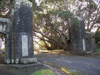
Matthews & Matthews, heritage architects, noted in their report for the Grey Lynn/Surrey Crescent Character Study (2004), that one likely architect may have been M. K. Draffin, the same architect who desighned the gates at Fowlds Park.  This suggestion was based on a similarity between a brick building for the Auckland Gas Company in Beaumont Street documented as being by Draffin. But, without any contemporary plans found (so far), and unless someone had a bit of time to trawl through Council minutes and correspondence, the designer remains uncertain.

Bricks were in short supply around that time, during World War II, as well, with supplies diverted for use in projects linked to defense needs. And yet, here these toilets stand, one of my favourites examples of Auckland architecture.

Crown Lynn homage on Rankin Avenue


This one is new this year, by S McCarthy. To be found just down from the Hutchinson/Margan/Rankin Ave intersection. The art features pottery and ceramics, especially that of Crown Lynn which was made just on the other side of Rankin Ave from this piece of street art.


Darn difficult getting a shot of the top of these boxes, without a step ladder ...

Saturday, July 24, 2010

An island called Motuketekete

From deed 64125, LINZ records, Crown Copyright.

On Friday last, I was at the Auckland LINZ office, looking through some of the deeds books for a commission research job -- and opened one of the old books to find the above: an 1880 map of a 59-acre island called "Keta Keta". I put the book to one side, and as soon as I'd finished finding what I needed for the commission, I returned to the story of  island.

Well, I'd never heard of the island before. Now, I realise that its name is Motuketekete, lying just across the South Channel; from Kawau Island in the Hauraki Gulf. But, I decided to look into what there is about the island's history.

The original crown grant was on 25 April 1850, from George Grey as Governor to Frederick Whittaker and Theophilus Heale. These two gentlemen had been  involved since 1845 with the setting up of a copper mining company at Kawau Island, their efforts opposed by the company already there at Kawau. According to Shirley Maddock and Don Whyte in Islands of the Gulf (1966):

"The original company were deeply hostile to the newcomers, and refused to allow Whittaker's miners to live on Kawau, so they had to camp on Motuketekete, an island a few miles south, and be ferried back and forth each day to the mines."
According to a Department of Conservation report on Kawau Island Historic Reserve, a rival smelting plant was set up on Motuketekete either in the late 1840s or 1850s. I wonder if any archaeology from that part of the copper mining story in the Gulf still exists there. It may even have been the island referred to by the Southern Cross, in a report from 28 May 1852, as "Captain Heale's Island":

"We had, however, rounded Wangaproa, and, with a brisk and bracing breeze, were entering a channel formed by the Kawau and its outlying islets. On our port beam was observable "the hole in the wall," an opening leading to Captain Heale's island, with a brig at anchor, but so faintly shown in perspective, that her tracery of spars gleaming through the leaden clouds, showed more like those of a phantom than a substantial collier. On the island the puff puff of the engine of a smelting furnace apprised us that the hand of the diligent maketh rich."
The partners purchased the title for ₤59, or a pound per acre. By March 1855, it seemed to have served whatever purpose it had -- Whittaker and Heale sold it to hotelier Bryant Vercoe for ₤100. 1855 and 1856 was when speculation seemed to run hot for Motuketekete. Perhaps there was still the sniff of copper or other riches associated with the island. Land agent and former hotelier Samuel Allen Wood bought the island from Vercoe in May 1855, for ₤175 (including a house there); then in February 1856 a gentleman named John Gouthwaite Brooke paid a whopping ₤485 for that piece of real estate. Something must have been there to have attracted so much money from Brooke. In October 1856, the island was purchased by George Wardell for a reduced ₤330.

Wardell (c.1832-1917), born in Scotland, went to Victoria to take part in the gold rushes there as a youth, and came to Auckland in 1855 on the Pioneer. He founded the commission firm of Wardell and Stephenson in March 1863 with Charles Stephenson, and seems to have had financial dealings with the colourful John Sangster Macfarlane.  Two years after starting his firm, though, Wardell had money troubles. In 1865, he was selling a number of properties, including Motuketekete.

"ISLAND of MOTU KETAKETA, situated in the Firth of the Thames, 2 miles distant from the Kawau (the residence of his Excellency the Governor Sir George Grey), 2 Houses, Out-buildings, Orchard, & never-failing spring of water, good landing and achorage in all weathers ..."
 (Southern Cross, 14 August 1865)

Macfarlane took up title for quite a few of Wardell's properties, including the island, that month. But somewhere along the line, Wardell made a promise to a miner named Noah Parsons that he could buy Motuketekete. Wardell and Macfarlane eventually gave Parsons his title for ₤155 in October 1872 -- but Parsons then sold it to accountant and banker George Schwartz Kissling the following month for ₤205.

Now, we come to the deed that attracted my attention to the island's story in the first place. In March 1880, Kissling sold the island to Matakana farmer George Scandrett for ₤140 (by now, possibly, the wild speculation as to any mineral resources the island may have held was over, it seems). According to the Auckland Regional Council site, Scandrett arrived from Ireland in 1863, and seems to have had an early association with Mullet Point, Mahurangi. The Scandrett family were to own Motuketekete from 1880 to 1907, when Hector Scandrett sold the island to Christchurch merchant Thomas Phillip Vivian for ₤190. The island remains in private ownership today.

Wednesday, July 21, 2010

Point ... Bunbury?


In Silverdale some months ago, I came upon a print of an old map of Auckland, one of the Felton Mathew maps from 1841, originally printed in London in August the following year. It is the earliest map I’ve seen that actually includes the district known today at Point Chevalier — but back then, the mapmakers had a different name gracing the tip of the peninsula: Pt. Bunbury.

Not only that, but a name for the area of the Waitemata Harbour between Point and the Rosebank Peninsula (the latter not quite making it onto the draughtsman’s page): Trent Bay. But, the point of this piece is about that man Bunbury. I suppose that if it hadn’t been for historical amnesia, that would have been the name of the suburb today.

Thomas Bunbury was born in Gibraltar in 1791, “on the wrong side of the blanket”, as the old phrase would put it. His father, Major Benjamin Bunbury, did at least give the baby his name if little else. Seven years later, Benjamin married and had legitimate children, who were to inherit his estate when he died in 1827 after being caught beneath an overturned pony chaise, and kicked by the flailing horse for three hours.

Thomas was educated in a Church of England school, and only ever invited into the Bunbury house once. He entered the British army at age 16, starting as an Ensign, and went on to serve in the Napoleonic Wars, in particular the campaign on the Spanish Peninsula. By 1822 he had risen to the rank of Captain, then Major by 1834. In 1838 he assumed command of the Norfolk Island penal colony. Things there did not go well. He was found to be harsh with his punishments, although he did reward good behaviour. In the end, angering the soldiers based on the island by ordering the destruction of their huts, they mutinied, and Bunbury was recalled off the island in July 1839.

Where to from there? Well, there was a place just starting up along the path to being a British colony called New Zealand. Here, he has some fame as St Helier’s first farmer, and during his four years in New Zealand ended up being a right-hand man to Governor Hobson, heading around the country gathering signatures on the Treaty of Waitangi.

On Hobson’s death, as senior military commander in the colony, he expected to take over as Governor — but this was not to be. Perhaps his state of birth did indeed impact on his career. He seems, despite his standing as a ranking military commander here at the time, to have had a rather out-of-the-way part of the new town named in his honour — and the name was quickly forgotten. He served briefly as Deputy-Governor under Hobson’s successor, FitzRoy, but in the end left in 1844 for the field of India. There, another promotion to Lieutenant-Colonel.

He retired around 1853, wrote a three-volume autobiography, and died on Christmas Day 1861.


The only name given to south Waitemata promonitories on the map above that has survived would be Britomart, through the Britomart Transport Centre we have today, which is close to what would have been the original point. But Pt Willoughby (possibly after Willoughby Shortland, the Lt-Governor under Hobson) is now Pt Erin. Pt. Fisher is just a corner of Victoria Park, under the motorway. Pt Stanley is underneath a lot of valuable downtown real estate. Pt Dunlop became St Barnabas Point, (not known who or what Dunlop was) and Pt Mathew -- after Felton Mathew -- became Campbell's Point (after John Logan Campbell) until it was destroyed for reclamations and the rail system.

Old signs never die ...

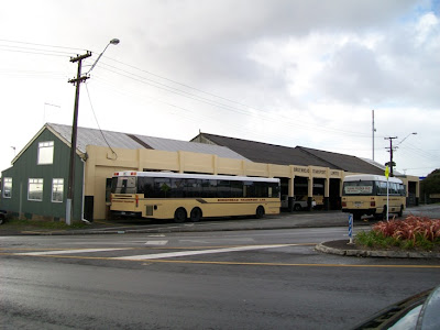
 ... if they still convey the message. Indeed, why change them at all, just because of some pesky municipal authority reshuffling? Take this notice, spotted this month on a Birkenhead Transport bus, heading towards Verran's Corner:


Smoking, alcohol and food are still not welcome on Birkenhead's wonderfully clean buses -- but the notice reveals its age. The "B.C.C." plus the use of the word "bylaw" point to this coming from the days of the Birkenhead City Council, which was absorbed in 1989 by North Shore City (and, in turn, will be gobbled up later this year by the Auckland Super-City ...)

Then again, why go to all the effort of printing up new signs, saying exactly the same message, when the old ones will do? Well done, Birkenhead Transport!

Murals at Birkdale Primary


On a wander along the roads in Birkdale on the North Shore, I came upon the Birkdale Primary School, established in 1894.

And admired a couple of their murals.


This is a wonderful summary of the history of both the school, and the surrounding district.

The school's beginnings, and the horticultural history of the area.


Left of centre, the Chelsea Sugar Refinery, and to the right, an early version of the Birkenhead buses. By the way, I do like their depot at Verran's Corner.


The original part of the building dates from 1936, with extensions in 1939 and 1957 as the business (which started in the early 1930s) grew.


Anyway, to finish off back at Birkdale School, even this modern-themed mural caught my eye.


Just goes to show you never know what gems you'll come across when there's a digital camera handy.

Rocky Nook's transplanted train station


Alongside Malvern Road and tucked between the street at the Western railway line, is a piece of redundant early Auckland rail history which has, fortunately, not ended up at the scrappers.

This part of Mt Albert was originally taken for railway purposes in 1911, quite possibly as plans were being laid down for the construction of the overbridge across New North Road. Part of the land taken was then raised for the necessary span across the road, leaving a small margin in government hands until 1996 when it was transferred to private ownership.

It was around this time that the 1912 station building at Mt Eden, along the track, was relocated here, and so has remained somewhat of a landmark for rail passengers passing along overhead: the station at which trains no longer stop.


Tuesday, July 20, 2010

Guest article: The first cricket match

My friend Diana Masters, previously mentioned here in relation to her book "Maria Ellen -- the Other Mrs. Kinder", has very kindly given permission for me to include her previously-published article on New Zealand's first ever cricket match, at the northern end of Horotutu Beach in the Bay of Islands, 1832.

Thank you, Diana.

The First Cricket Match

For those cricket fans visiting the Bay of Islands, you may want to pay tribute at the site of the first cricket match in New Zealand.

The missionary William Williams had ordered a set of cricketing equipment from England, and it arrived in time for Christmas, 1832. On the 20th December the Rev Henry Williams wrote in his journal that he “turned the boys out to play cricket by way of a finish…Very expert, good bowlers”.

Edwin Fairburn (b.1827), son of the missionary, in his recollections (MAHARATANGA, Reminiscences of Edwin Fairburn [1901] NZMss91. APL), written seventy years later, described the excitement of the match.

The only ball game with which he had been familiar was ‘round trap’, rather like rounders. He thought that the new game must have some connection with green insects with long legs. The afternoon of the match was bright and calm, and all the inhabitants of Paihia and the Bay of Islands went to the northern end of Horotutu Beach.

Some 40 or 50 played for each side, there were no overs, but the ball was thrown to the bowler nearest to the fielder, or which ever end the fielders chose. The fielders pleased themselves as to the position they took and ‘things were carried out in a very independent manner’.

The 5 year old Edwin and his friend John Williams were allowed to play, but they were the youngest. Edwin describes his innings.
“Mr W Williams who bowled to me saying “we mustn’t be too hard on the youngsters” – or something to that effect, delivered me a very nice ball which I hit over the bank (about eleven yards off) on to the beach where it rolled down some distance on the hard sand – and I got a run – at which our side applauded – while the other side grumbled and called out for short work to be made of me – the ball was thrown up to the opposite end bowler, who straightaway bowled me out – but I got in a run in the first game of cricket played in New Zealand.”
Edwin included a map of Paihia where the site of the wicket is clearly marked, although his remembered date is a year out. He wrote “I think I could mark it out now within 10 feet of the actual. The northern end of the wicket was about a chain from the base of the steep hill and the side about 35 feet from the edge of the firm bank next to the sand”.

It can be easily seen today – at the northern end of Horotutu Beach (that’s the beach with the wharf) on the beach side of the junction of Bayview and Marsden roads, just before the rocky outcrop.

Sunday, July 18, 2010

Fading Past? Hobsonville’s Sunderland seaplane hangar


 The following was written for the July 2010 issue of the West Auckland Historical Society's newsletter.

The placenames of the district of Hobsonville has a redolent mix of two completely different heritage themes. The 19th and early 20th century industries, the potteries, brickyards and lime kilns, are celebrated in Limeburners Bay, Brickbat Bay, and Clark Road. While from the 20th century, an age between wars and in their wake, come Bofors Point, Nimrod Inlet, Orion Point, Bomb Bay, Catalina Bay. At the old Hobsonville Air Base itself, there are streets named for past commanding officers: Isitt, Calder, Buckley and Carnegie.

How much of these two combined and overlapped themes from Hobsonville’s past will remain for the future, in the face of plans to create massive housing estates beside the waters of the upper Waitemata? One part of the picture of Hobsonville’s history does have WAHS President Trevor Pollard concerned: the fate, yet to be determined, of the old Sunderland seaplane hanger.

The first use of the airfield at Hobsonville was by a civilian, F D (Doug) Mill who owned his own Gypsy Moth and set up his Air Survey & Transport Ltd operation in 1927, specialising in aerial photography, repairing and selling aircraft, and providing passenger transport. Mill’s operations were to continue until 1940.

The first seaplane hangar was completed in 1929, once Hobsonville became a government-owned base, part of a development including commanding officer’s residence, central office, and cottages for the men. The 1937 Cochrane report, recommending a separation of land and seaplane operations, led to the establishment of Whenuapai and Ohakea airbases, and the development of Hobsonville as a Repair and Equipment Depot, and seaplane base.

Imperial Airways successfully carried out the first mail flight across the Tasman Sea in December 1937, and this led to the establishment of Tasman Empire Airways Ltd (TEAL). TEALs operations were at Mechanics Bay, but as Hobsonville was the government’s repair depot, it was decided to build a large hanger in 1939 near the existing hangar and workshops for the maintenance of TEAL’s seaplanes.

In 1942, the repairs section at Hobsonville was relocated to Hamilton, but two years later came the arrival of four Sunderland flying boats from the United Kingdom – the aircraft that the larger hangar at Hobsonville would become associated with from that time onward. The coming of the Sunderlands meant extensions to the seaplane apron, already used to capacity by TEAL aircraft, Walruses and Catalinas.

Photos taken May 2010.
The seaplane era at Hobsonville ended with the retirement of the Sunderlands in the mid 1960s, the last flying from Fiji to Hobsonville in 1967. The focus of the base shifted to helicopters, but the base eventually closed in 2002.

Sources:
Hobsonville Landing AEE (Archaeology, Rod Clough and Sarah Macready, 2009
Former Hobsonville Airbase, A Heritage Assessment, Dave Pearson, 2008

An enigma beside the Otamatea River


My good friend from Mad Bush Farm has been chasing down info on the Queen Victoria bust at the Otamatea Marae for some time now,  longer than Timespanner's been in existence. So, I'm not posting this to steal thunder or other stuff like that, but -- this is certainly a mystery and a half. I'd like to know more.

The known facts are these: Dick Scott in his book Seven Lives on Salt River (1987) wrote:
A concrete plinth standing before the Ngati Whatua meeting house opposite the 'Cathedral of Gittos' at Tanoa is waiting for the return of a plaster and wood bust of the young Queen Victoria that Governor Gore Browne gave to the tribe as a reward for loyalty to the British during the wars for the land. Until the royal head is set in place, aluminium frame windows are the only feature of this unusually bare wharenui set in an empty paddock.
The plinth is outside a plain building Scott says was Aotearoa, a meeting house once at Aotea or Shelley Beach in South Kaipara, shifted by raft and bullock team from Shelley Beach to the mission village at Kakaraea (Tanoa). A shift which happened, according to Scott, in 1887. The bust had been store, Scott said, at Whare Maori, the "Devil's House" at Ratana Pa, then held on deposit at Auckland War Memorial Museum for the Otamatea Marae. Today, it appears, it has been restored to reside inside its aluminium and glass enclosure.


The enigma is the plaque applied to the plinth below the bust's latest home. Right now, I suspect that it is either a historical red herring, or an indication that the bust came from further afield than even Shelley Beach to begin with.


QUEEN VICTORIA
THIS SCULPTURE OF THE
YOUNG QUEEN VICTORIA
TOGETHER WITH UNION JACK
WAS PRESENTED BY
GOVERNOR GORE BROWNE
(1855-1861)
TO NGATIWHATUA CHIEFS AT
AOTEA (SHELLEY BEACH) KAIPARA

Scott provided a handsome photo of the bust in his book, sitting on and surrounding by the Union Flag. The photo was taken by David Reynolds, from the Auckland Institute and Museum Library, with permission of the Otamatea Marae Committee. I suppose the plaque pre-dated the move back to Tanoa, because Scott does appear to have used it as a source (reference to "young Queen Victoria", and that flag which is no longer in evidence at the Tanoa site.)

But ...

I have yet to find a reference to any meeting Governor Gore Browne had with Ngati Whatua chiefs at Shelley Beach. He did meet with them -- but at Kohimarama, here in Auckland, in the winter of 1860, at the first of the Maori Parliaments discussing the Land Wars issue. No record found, though, of the Governor reciprocating in the face of gifts given to him by the visiting chiefs, with a wood/plaster bust of young Queen Vic.

The earliest description of the bust in situ at Shelley Beach comes from a report in the Weekly News of 28 February 1885, two years before things were shifted up north. The report is that of a railway and steamer excursion to Helensville and surrounding districts:
At Shelley Beach the excursionists were speeedily and comfortably landed in two boats, and immediately spread out to do the "lions" of the locality, which consisted of the large Runanga House, or Native Parliament House of New Zealand, an obelisk, in the recessed faces of which (protected by glass) are inscribed the text of the Treaty of Waitangi in English and Maori, and the native settlement. The obelisk is surmounted by a bust of the Queen.
There's no mention there of union jacks, unless they were behind the Treaty of Waitangi plaques (which are not together with the bust today). Sadly, also, no mention of the Governor Gore Browne connection -- but this was just a smidgen of a longer report on the whole exciting day. Those plaques, though, might date the bust and obelisk. In 1880, another obelisk including memorial plaques to the Treaty was designed by Buchanan of Auckland and installed at Paihia, in the Bay of Islands. That one still exists at the Waitangi Treaty Monument. Perhaps the original plinth at Shelley Beach looked like that, without the surmounting obelisk -- instead, the bust of Queen Victoria? Maori worked to increase awareness of the Treaty in the period both immediately before and after the 40th anniversary of the Treaty's signing. Not hard to see why, after the land confiscation record and the activities at that time of the Native Land Court mopping up much of the remainder.

There is one event I have yet to look into: a Maori Parliament of some note held at Shelley Beach in late November 1884. Papers Past references sadly mention it only in passing (another one of those so-called 'Parliaments' the natives kept holding, in the minds of European settlers, hardly worthy of much note on the national scale). The only reference I found there was from the North Otago Times, 14 November 1884:
The Northern Maori parliament will meet at Kaipara on tho 22nd inst. This is a gathering of Ngawhatua under the auspices of Paoro Tuahera, and Tawhiao has promised to be present. 
 This is an echo of what the Helenville & Districts Historical Society have recorded on their website:
In 1884/85 Aotea, as it was formerly called, was the venue for an important meeting between Ngati Whatua and King Tawhiao of the Waikato. The issue was whether or not the local people should join the King movement. After much discussion they did not. At this meeting the Council Hall, Te Tiriti, was opened and a four sided memorial with a copy of the Treaty of Waitangi set under glass on two sides was erected with Government funds. It was surmounted by a likeness of Queen Victoria. It stood there for many years and was regarded with great reverence by Maori. Later the buildings and memorial were barged to Batley near Maungaturoto.
 So ... I need to see what the NZ Herald, Auckland Star, and Weekly News recorded, if anything much, about that meeting of the Maori Parliament. By that stage, however, there was little if any connection with Governor Gore Browne. 

So -- a red herring? Or something more ...?


Update 28 April 2011:

Liz from Mad Bush Farm has found the following on Papers Past about Shelley Beach and the bust. Thanks, Liz.

Monument at Tanoa references

The party, shortly after arrival of the train, proceeded by the s.s. Aotea to Dargaville, being accompanied as far as Shelly Beach by Messrs Jas. McLeod, J. A. Wilson, Jas. Hand, and F. Tucker (acting Town Clerk). Mr McLeod pointed out the improvement that had been made to the Kaipara River by the removal of rocks in the channel, and asked for a landing stage at Shelly Beach, where he intended to offer a reserve of 26 acres to the people of the district as a pleasure resort. He also pointed out that the monument erected on the beach in honour of the Treaty of Waitangi, some 25 years ago by the Government, was sadly in need of repair, and that the copy of the Treaty which was let into the monument and mounted with glass, was almost obliterated by exposure to the weather. Mr Massey, who seemed pleased with the outlook of Shelly Beach as a camping ground, said although it did not come within his department, he would do what he could in the matter of forwarding the project and getting the monument put into repair.

Kaipara & Waitemata Echo 15 January 1913

SHELLY BEACH.
AS A PEOPLES' RESERVE.
There is not the least doubt of the suitability of Shelly Beach as an ideal camping ground and pleasure resort and a reserve there of 26 acres offered free to the people of the district should be accepted without hesitation. The proposed area takes in practically all the beach including a large piece of flat ground on the top of the cliff which could be made into a very nice park, having near the edge old Maori redoubts and rifle holes, which with very little expense could be reserved. The face of the cliffs are covered with native bush which affords excellent shelter, and on the beach there still remains the old Maori Church and a Monument in commemoration of the Treaty of Waitangi. Mr Jas. McLeod who is offering the gift to the people, informs us that it could be invested in three trusts representing the Helensville Town Board, and Kaukapakapa and Maratahi landings of the Waitemata County Council. In his opinion the area, although large enough at the present time, may be found a small reserve in the future and that if the people of the district took the matter up, it would be to their advantage to acquire another fifty acres, which could be done, at a very low price, and therefore have a suitable reserve for all times. What makes the proposed reserve of more importance is that a read could be brought from the main road right on to the Beach, allowing of easy access by land as well as by water, and with a suitable landing stage erected by the Government, people for all parts should be attracted to this spot.

15 January 1913


30-Acre Public Reserve.
At Shelley Beach
Given by James McLeod
Reporting to the Waitemata County Council on Friday, the Engineer (Mr R. G. Jackson), in. reference to the South Head road deviation, stated that when surveying this road some time ago he also laid off a branch road to Shelley Beach—the only deep water in the district. This road crossed a block of Maori land known, as Aotearoa, and it was intended to take the road by warrant. The block had now been acquired by Mr James McLeod, and there is some prospect of a portion of it being re-sold. If the block was sub-divided there would then be trouble and expense in getting the road. He had persuaded Mr McLeod to offer the road to the Council, and be recommended the offer be accepted.

Cr McLeod said that ever since it had been intended, to put that road there it had always been argued that it was at the only deep water between there and South head. It was in the interests of district residents that dedication of this road should be taken. If he parted with portion of the land another owner may want compensation for a road, but he was prepared to give it at the present time, his only stipulation being that a gate should be left on the boundary; otherwise it would cost him a good sum for fencing. Besides the road he was also giving Shelley Beach Reserve, a piece of land comprising 30 acres, for a public picnic ground. The only question was as to whether the Council was prepared to take the road, which would prove useful, although the people of Helensville had access to Shelley beach by way of the river. The Chairman said the offer was a generous one. The Council decided to accept dedication of the road; and on the initiative of Cr Poynton passed a further resolution expressing the Council's appreciation of the generous gift.
Kaipara & Waitemata Echo 2 July 1913

Update 6 June 2011:

Liz found the second item, which made me dig for the first, of the following:

(At the Orakei Parliament)
Te Keene Tangaroa said he would build a Parliament House for next year at Kaipara. As the preparations would occupy all his time, he would not be able to go to Te Kopua.
Auckland Star 6 March 1879

Another old and loyal Maori chief has just passed away in the person  of Te Keene Tangaroa, of Shelly Beach, Kaipara. This chief was a  consistent friend of the Europeans, and his loyalty to the Queen led  him to oppose successfully the proposal to shift the venue of the  Maori Parliament to the Waikato. He had an obelisk erected at Shelly  Beach in honour of the Queen, and to commemorate the Treaty of  Waitangi. He was a Government Assessor, and was in receipt of a Government pension.
Auckland Star 8 December 1885


Which puts the bust as dating (possibly) somewhere between 1880 and 1884 at Shelly Beach.

Saturday, July 17, 2010

Guest Post: The Charlotte Museum

I got to visit the Charlotte Musem recently, curious to see just what a thematic collection of artefacts on the lesbian contribution to the history of New Zealand looked like. Set in an area of light industry, in Mt Albert, the museum takes advantage of the concrete floors to help preserve their collections. They have much to engage the social historian  in terms of timeline and photographic displays. I do recommend to anyone to pop on down there to take a look. -- Timespanner.

The Charlotte Museum of lesbian history is organising what it expects to be the first of many local history events on Sunday September 12.

It will describe what is involved in the founding of a community museum, and different attitudes to women who loved women from the time of colonisation to the present. The event starts at 2pm, and will be followed by nibbles and drinks. Entry is by koha.

The Charlotte Museum, the only lesbian museum in the world, is tucked away in suburban Mt Albert. It moved from its original site in Grey Lynn in November 2009 and opened again in February in a small industrial estate off St Lukes Rd at unit 7a, 43a Linwood Ave. 

It is open to the public on Wednesdays from noon to 4pm and Sundays from 1.30 to 4pm. The museum was founded by Miriam Saphira, and is run by the Charlotte Museum Trust.

The local history event is part of a regular programme of public events and exhibitions. Volunteers are cataloguing its significant collection of lesbian books, magazines, posters, records, coasters, and other ephemera.

Its first exhibition, a survey of lesbian life in New Zealand from the 1800s, was followed by ones on theatre and sexuality. Volunteers are working on forthcoming exhibition about lesbian music and lesbians in sport.

The museum is a treasure trove of fascinating images, artifacts, memorabilia, posters, artwork and information.
The wall displays include prominent New Zealand women who had relationships with women, significant lesbian events from the 50s and 60s, two quilts made out of lesbian and lesbian and feminist t-shirts, and panel from the opening and theatre exhibitions. 

Museum staff and volunteers are knowledgeable members of the community who can expand on aspects of the exhibitions for members of the public who want more information.

Events in 2010 included an Anzac Day talk and photos about the Pramazons, a lesbian feminist peace group that pushed prams from Whakatane to Gisborne in 1983, performing puppet shows, concerts and theatre about a nuclear-free and independent Pacific at local halls every night. 

In May, the museum celebrated the centenary of the birth of Tuini Ngawai, a prolific Ngati Porou songwriter, composer, kapa haka teacher and champion shearer who had relationships only with women. 

In June and July, the museum hosted gay community events talking about the different experiences and perspectives of older and younger lesbians, gay men, takataapui and transgender people, and encouraging dialogue between the generations. 

Contact the museum on 847 5327 or 021 237 0613, email charlottemuseum@gmail.com or see http://charlottemuseum.net.nz

Friday, July 16, 2010

A walk through Fowlds Park, Mt Albert

Fowld’s Park has been a place I’d wanted to see for quite some time, at least since I started chasing down information on Forbes Eadie and saw references to the park under its former name, Morningside Reserve, when I was researching for Wairaka’s Waters. Thanks to Carron Boswell of the Mt Albert Historical Society who took me on a walk one day recently along the by-ways of suburban Mt Albert, I finally came upon the place – and decided to check into its story.

Dick Scott in his book In Old Mt Albert and subsequent texts and reports (including the latest Auckland City Council Management Plan for the park, 1992) that slavishly followed his work without checking with primary sources have provided inaccurate information about how the park came to be in Council hands. Scott wrote that the land was swapped between Asylum authorities (as an endowment reserve) and the Mt Albert Borough Council in 1912 for land held by the Council near the Asylum over at Pt Chevalier. All with the assistance of the local MP George Fowlds, who was Minister of Education up until he resigned his portfolios in September 1911.

Not entirely correct, though. The park, Lots 176 and 177 of Section 10 Suburbs of Auckland, tucked in below part of the Western Springs Road ridge, was Asylum endowment reserve until 1892 when there was a land swap between the Asylum authorities, and the School Commissioners who administered education reserves in the Auckland area (Transfer No. 13878, LINZ records). The land granted by transfer to the Asylum lay between the Oakley Creek and Great North Road in Waterview, so was never land owned or controlled by Mt Albert’s territorial authorities (actually, it came within the boundaries of the Avondale Road Board). The land at Morningside is still, for all intents and purposes, Crown land, coming under the Reserves Act 1977 as gazetted in March 1980. (NA 65/189, LINZ records) But Mt Albert Borough, later Mt Albert City, and still later Auckland City Council have maintained and administered the reserve since 1912.

Back in early 1911, the Mt Albert Borough councillors had their eye on the reserve, leased out at the time to a local cattle owner by the name of Edmund George Sandall (Sandall may have been the son of a butcher named R S Sandall who had a long-established business in Auckland from at least the late 1860s). Fowlds, then Minister of Education, interceded with the Lands Commissioner who administered the former education endowment reserves in the district, and there are references in the Borough’s minutes of transfers expected to be completed shortly as at mid 1911. But, Fowlds then split from his party in Parliament, striking out on his own in early 1912. Possibly this was one of the reasons why the i’s were not dotted, nor the t’s completely crossed in terms of the official transaction. Sandall still retained his grazing lease over part of the reserve, at least up until 1926 when he complained that his cattle were escaping due to poorly maintained fencing, and 1927 when there were reports of a “dangerous cow” menacing the public, and his lease was reviewed by the Council.

The reserve was sizeable – 29½ acres – but wasn’t considered in 1892 to be of great value (the land it was swapped for was only 9½ acres, described in the transfer as being of “equal value”). That was probably much the case as far as the Mt Albert council was concerned in the early years, although right from the start, they hoped to turn it into a recreation area, a place to be beautified, perhaps with croquet or bowls in mind. But along with Sandall’s grazing rights on part of the area, the council through its Mt Albert Domain Board also permitted quarrying and metal breaking by the firm J E Martin and Co from 1913, and it seemed to be a good place to use as a rubbish tip from that time on.

Now, this is not an exhaustive history of the park, not by any means, so please excuse me while I skip ahead to the mid 1920s. This is a time after the emergence of the Morningside Residents and Ratepayers group, led by rabble rouser Forbes Eadie, who took on the Council over rats and filth at the tip in 1921, then campaigned afresh to have the tip closed after the 1922 typhoid outbreak. Eadie, who lived on Malvern Road backing onto the reserve, ended up being declared an Honorary Warden of the Morningside Reserve from at least 1929 until 1932. From the time of the rubbish tip protests, the Mt Albert council began to see their Morningside Reserve in a new light, and with great possibilities.

Playing areas and shelter sheds were already in existence by 1926. In 1927, Wilfred Ernest Begbie drew up a plan for the redevelopment of the reserve which, if actually carried out, would have made a stunning feature on the Mt Albert suburban landscape. His plan (MAC 001/540/182, Auckland City Archives), including ferneries and pavilions, terraces for watching sports matches, fields set aside for hockey, football, bowls, croquet and a cycling and athletics track, even an ornamental pond with its own island connected by walkways, would have turned the reserve into a smaller version of the Auckland Domain. Soil and spoil from other quarries in the area were trucked in to fill the reserve from 1926, and rock excavation for the football field was in progress by 1929.

(MAC 029 No. 55  Photograph of opening of commemorative gateway at Fowlds Park by Mayor Raymond Ferner, 
2 March 1935, Auckland City Archives, by kind permission)

Ornamental gates were first planned for the Asquith Avenue entrance, but by the early 1930s, these had shifted to be constructed at the top of Rocky Nook Avenue. George Fowlds, knighted in 1928, died in August 1934 but was aware before his death of the Mt Albert Council’s intention to name the Morningside Reserve Fowlds Park after him, and to construct a special memorial at the gates to the park. Mt Albert Mayor Raymond Ferner opened the gates on 2 March 1935 – and was the one in his speech to start the ball rolling on the misinformation passed down as to the park’s origins.

“It was as a result of Sir George’s foresight while he was Minister of Health that the park area, originally a mental hospital endowment, was secured in exchange for another area.”
(NZ Herald, 4 March 1935)

Ah, well. Such is the way historical misinformation starts to bloom.

Ferner went on:

“The land was originally rough, but successive administrations had laid down tennis courts, children’s playgrounds, croquet lawns, and netball and cricket grounds. Carriageways were now constructed through the park and plantations of trees established. One of Sir George’s last public appearances was made last Arbor Day, when he participated in a ceremony and planted a tree only a few yards from the gateway.”

Could this have been a monument for that last Arbor Day of George Fowlds life? I'd need to try to track that date down, and see if I could find a report (and then perhaps look at the Council minutes), but -- the quote is definitely one that was associated with Arbor Day from the late 19th century, according to Papers Past.

Who does his duty is a question
Too complex to be solved by me,
But he, I venture the suggestion,
Does part of his who plants a tree.
James Russell Lowell

No mention in Ferner's speech, of course, of the quarries, the dangerous cows, the rubbish tip and the rats …


(MAC 001 No. 555 Item 197 Monumental entrance to Fowlds Park, M K Draffin, half elevation, Auckland City Archives, by kind permission)

The gateway was voluntarily designed by noted architect Malcolm Keith Draffin. This from the Who’s Who, 1938 (via this site on the Draffin family):
A.R.I.B.A., F.N.Z.I.A., Architect 810 Sth. British Insurance Building, Shortland St, Auckland. Member Architectual Assoc. London and Town Planning Institute of NZ. Born Auckland 1890. Son of William Henry and Sarah Emma (nee Fox) Draffin, both of Manchester, Eng. Educated in Auckland. Commenced his professional career, articled to John M Walker, Auckland 1906-1910. 1910-1914 with Edward Bartley as Second Draftsman, and later Chief Draftsman. Enlisted 1914 as Sapper with NZ. Enginerrs; saw service in Egypt, Gallipoli and France; decorated with M.C., twice mentioned in despatches and gained Lieutenancy in France. Returned 1919 and resumed profession as partner in the firm of Edward Bartley, Son & Draffin, of which he became the Proprietor. Practised under his own name 1920-1922. Amalgamated with Grierson & Aimer, 1922, and the firm name became Grierson, Aimer & Draffin. In 1932 this firm dissolved partnership and he again practised under his own name. Married: Terepa Pera, only daughter of William Graham Jackson, of Nelson, NZ., 1921. Issue: Two sons. As M.K. Draffin, Architect - general practise; War Memorials, Factories, Warehouses and Residences; as Grierson, Aimer & Draffin - Architects for Auckland War Memorial and Museum, Wellington War Memorial, Theatres, Warehouses, Office Buildings, Factories, Flats, Residences, etc.


The gates, and that tree Fowlds planted (if it still exists) should be considered for the Auckland City Council schedule on the District Plan, along with the Arbor Day plaque (probably beside the tree).


They seem to be missing the MABC shield-shaped plaques on the arches – but the photo from 1935 doesn’t show them in place. Were they ever there, or just simply too expensive in the end?


Today’s Fowld’s Park, somewhat sadly, bears little resemblance to Begbie’s dream from 1927. It is a pretty park, and pleasant to walk through, but the grand ideas of carriageways, winding paths to islands in the middle of ornamental ponds and vast multi-sports grounds seems to have gone the way of most things when things like recessions and Great Depressions come along to derail plans.

Where the clubrooms are at the left was supposed to be Begbie's ornamental pond, with island and walkway bridges.

Here, were to be open terraces, where people could come to watch athletics and cycling at the left.


Perhaps something of Begbie's Pond still lurks, and rises up during wet winters to sit on the surface, amidst the lined-up rocks (perhaps from the quarrying carried out here in the early day? Who knows?)


But -- Fowlds Park is a nice place. Probably not well-known unless you're a neighbour, or one who uses it for sports or walking. Definitely worth more than just one look, both in terms of what is there today, and its fascinating story.

Sources:
Mt Albert Borough Council minute books, MAC 100 series, Auckland City Archives
Plans and letters from Mt Albert Borough Council Records, Auckland City Archives (who also gave me permission, greatly appreciated, to reproduce the photo and design detail for the gateway here.)
NZ Herald, Auckland Star
My own research on Forbes Eadie
Fowlds Park Management Plan, 1992, Auckland City Council
In Old Mt Albert, Dick Scott (2nd edition)

Thursday, July 15, 2010

Goodbye to the Swinging Cow?


Well, I hope not, but there's a "For Sale" sign in one of the windows.


This is a landmark for travellers along SH1 in Brynderwyn, Northland. I like it because of the name, mainly. I don't think I've actually had anything to eat or drink there, more's the pity. Would have loved a chance to have done so before progress made changes.

These days, the InterCity buses (Northliner Express etc.) stop at Kaiwaka -- here, at the "Gateway North Motel & Cafe":


Now, yes, I have had two items from here. Heading up on Saturday morning, I bought a mince & cheese pie for $3.50. The pie was barely lukewarm, and the grated cheese inside still looking a lot like it had just come off the grater, and not its proper gooey-ness. Still, food is food, I was hungry (no brekkie before I left), so I ate it.

On the way back, purchase of choice (both made mainly so I didn't have to feel guilty when I saw the sign over the loos saying they were for customers only) was a cheese & onion sandwich. It was a bit on the dry side. I didn't finish it at my quick lunch break back in Auckland.

InterCity may have decided to stop at Kaiwaka since 2007 because of the bus bays in the carpark. Maybe the whole development was designed around that feature. But aside from the great woollen scarf I bought at a stall outside the cafe on Saturday morning -- there's not a lot going for it except the toilet stop. I'm not sure what I'd buy next to assuage my pangs of guilt next time. Maybe just a soft drink. I don't think I'd like to try facing the tucker again.